
Editor’s Note (10/07/16): As Hurricane Matthew barrels toward the U.S. coastline, Scientific American reviews some of the science involved in predicting, tracking and understanding these massive storms. This article—originally published on 10/21/2014—looks at the science of monster storms.
"Toto, I've a feeling we're not in Kansas anymore," Dorothy said in The Wizard of Oz after a tornado—that most American of extreme weather events—deposited her into a land over the rainbow. In a typical year some 1,300 real tornadoes rip across the U.S., hitting the Midwest's "Tornado Alley" far more frequently and severely than any other region on earth. The most fearsome of tornadoes—the deadly Wicked-Witch-of-the-East-slaying, enhanced-Fujita-scale-5 (EF-5) twisters, which contain top winds exceeding 300 kilometers per hour—have hit the U.S. 59 times since 1953. Only one EF-5 has ever been documented outside the U.S.—in Manitoba, Canada, in 2007.
Tornadoes are just one type of extreme storm that Scientific American magazine has long documented. Its detailed coverage of tornadoes, for example, began as early as 1897 with the publication of "The Varying Power of Tornadoes and Their Frequency," continued in 1927 with "Our Worst Storm, the Tornado," and began to delve deeply into physics behind tornado formation in the 1958 article "Tornadoes," by NASA meteorologist Morris Tepper. From some of these early investigations, we learn that the key ingredients to make a tornado include:
- Moist, warm air at low elevations—readily available from the Gulf of Mexico.
- Cool, dry air at higher elevations—readily available from Canada.
- A strong southerly wind at the surface, plus a strong wind aloft blowing above it from a different direction, usually westerly or southwesterly, which creates wind shear and gets the air spinning.
- Some lifting mechanism, such as a cold front or storm line, which drives the warm air upward.
Every year—particularly in March through June—these ingredients come together in Tornado Alley to produce multiday tornado outbreaks that are stunning in their power and devastation.
Thanks to Doppler radar, field studies and computer modeling during the past few decades, meteorologists have made much progress in understanding tornadoes. Yet as distinguished tornado expert Robert Davies-Jones explains in his 1995 article, "the storms that spawn twisters are now largely understood but mysteries still remain about how these violent vortices form."
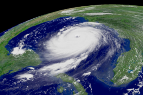
The deadliest and most expensive natural disasters in U.S. history, however, were both hurricanes: the great Galveston hurricane of 1900, which killed some 6,000 to 12,000 people, and the notorious Hurricane Katrina in 2005, which caused an estimated $149 billion in damages. Scientific American covered both great storms. Isaac M. Cline, chief meteorologist at the Galveston, Tex., office of the U.S. Weather Bureau (later the National Weather Service) during the Galveston hurricane, wrote "Special Report on the Galveston Hurricane of September 8, 1900," in the October Supplement. Cline's pregnant wife perished in the storm, and he himself narrowly escaped drowning in the devasting storm surge.
The impact of a Katrina-like hurricane in New Orleans was described four years in advance, by Scientific American editor Mark Fischetti in his 2001 article, "Drowning New Orleans." He chillingly predicted that "a major hurricane could swamp New Orleans under 20 feet of water, killing thousands." In the end, at least 1,800 died in that storm—despite more than a century's worth of advances in prediction and early-warning systems developed after the Galveston storm.
For as long as we have been trying to understand these storms, we have been seeking to find ways to stay safe from them. One idea was to lessen the force of the storm itself. Cloud-seeding efforts to tame hurricanes began in 1961 with the Weather Bureau's Project Stormfury, as we learn from the 1964 article "Experiments in Hurricane Modification," co-authored by the future director of the National Hurricane Center, Robert H. Simpson. (Simpson helped to develop the famed Saffir-Simpson Scale that ranks hurricane strength as Category 1-5.) The lack of supercooled water in hurricanes ultimately doomed these cloud seeding efforts. The dream of artificially weakening or changing the paths of these destructive storms lives on to this day, though, as explained by Ross N. Hoffman in his 2004 article, "Controlling Hurricanes."
The future of hurricanes and other extreme storms is not likely to be a quiet one. Rising sea levels, in combination with stronger storms because of climate change, are expected to greatly increase damages. Kevin E. Trenberth of the National Center for Atmospheric Research warned in his 2007 article, "Warmer Oceans, Stronger Hurricanes," that "global warming is raising sea-surface temperatures. That rise, in turn, will probably bolster the intensity of hurricanes, including those that target the Americas." Fischetti's look back in 2013 at how Superstorm Sandy impacted the northeastern U.S., "Storm of the Century Every Two Years," cautions that "the chances of severe flooding in New York City will be as high as one in two each year by 2100."
My forecast for the future of extreme weather: expect the unprecedented. I also predict we will see a large increase in the number of Scientific American articles devoted to extreme weather as human-caused climate change propels us into a new, higher-energy climate, capable of delivering extreme weather events unlike anything in recorded history.
Spread the word