
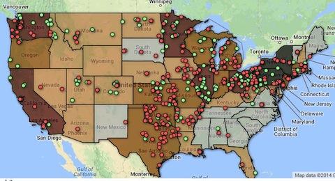
This collaborative project features maps and other visualizations showing the chronological geography of dozens of social movements that have influenced American life and politics during the 20th century, including radical movements, labor movements, women's movements, many different civil rights movements, environmentalist movements, and more. Until now historians and social scientists have mostly studied social movements in isolation and often with little attention to geography. This project allows us to explore the relationships between social movements by bringing them together in time and space. It enables new understandings of how social movements interact and how they reproduce and change over time. We do this by developing detailed geographic data and metrics about each movement, allowing us to identity locations where membership and activism were concentrated.
The links left and below lead to more than 80 visualizations and data tables, with more to come. We have started with dozens of maps and charts that show the activist geography of the NAACP, United Farm Workers (UFW), Socialist Party, Industrial Workers of the World (IWW), Communist Party, Congress of Racial Equality (CORE), and League of United Latin American Citizens (LULAC). We are now working on SNCC, Black Panther Party, the Chicana/o Movement, and underground newspapers from the 1965-75. The National Woman's Party and NOW are next. We will add data and maps for other organizations as we move forward.
Socialist Party Activity 1900-1940
Here are more than two dozen interactive maps and charts that show the geography of Socialist Party activity. One set maps electoral support, showing the number and percentage of votes for SP candidates in every county across the country. Another set displays SP membership by state and year, in both maps and charts. A third database maps the location of 380 newspapers associated with the Socialist Party. Finally we map the 353 towns and cities that elected socialists to public office between 1904 and 1920. These are interactive maps that can be filtered on a number of variables while providing detailed information about places, publications, periodicals.
Industrial Workers of the World Activity 1905-1920
These interactive maps locate more than 1,800 strikes, campaigns, arrests, and vigilante events involving the Industrial Workers of the World from 1905 to 1920. Events can be filtered by year or advanced in a month by month sequence. They can be filtered by state or type of event. Hover to see short descriptions. A second set maps more than 900 local unions affiliated with the IWW with filtering by industry and date of operation. (These visualizations are hosted on our companion IWW History Project).
NAACP at the Grass Roots 1909-1977
From an early date, the NAACP was a grass roots organization with a membership that expanded across the nation. These interactive maps and charts show the growth of the NAACP from a single branch with a few members in New York City to 80 branches by 1917, to 400 branches in 1923, then surging to more than 1,000 branches and 300,000 members during World War II, and then the regional surge into the South in the 1950s and 1960s.
Communist Party membership and support 1920-1948
Here are several maps and charts that show where the CP was active and where party support was concentrated. We show changing party membership by region and follow county by county and election by election the number of votes won by CP candidates. In close detail, CP activities in Chicago are mapped.
CORE sit-ins and other demonstrations 1942-1970
Founded by black and white students at the University of Chicago, the Congress of Racial Equality pioneered key tactics of the modern civil rights movement. Here we map more than 600 demonstrations organized by CORE and show the changing activist geography as the organization first attacked segregation in northern cities, then moved south sponsoring Freedom Rides and other forms of civil disobedience.
UFW strikes, boycotts, campaigns 1965-1975
When ethnic Mexican farm workers led by Cesar Chavez joined with Filipino American workers led by Larry Itliong in 1965 to strike grape growers in Delano, California, the modern farm workers' movement was born. Here we map more than 1000 strike actions, boycotts, and other UFW related events showing the movement's support across the United States and Canada.
League of United Latin American Citizens 1929-1965
LULAC was founded in Corpus Christi in 1929 and added 18 councils the next year, all but one in Texas. With World War II, LULAC began to extend its reach to California, Arizona, New Mexico, and later Colorado, claiming 82 chapters by 1955. The next decade brought LULAC new influence and a new geography, reflecting the Tejano diaspora that was now spreading into the upper Midwest.
About the Project
Directed by Professor James Gregory, the project has been supported by a Digital Humanities grant from the Walter J. Simpson Center for the Humanities, by the History Department Hanauer Fund, and by the Harry Bridges Center for Labor Studies, all at the University of Washington. The Mapping Social Movements project includes two stand-alone websites IWW History Project--The Industrial Workers of the World 1905-1935 and Upton Sinclair's End Poverty in California Campaign. These are collaborative efforts, depending upon contributions from many scholars.
Spread the word