
Mapping American Social Movements; Through the 20th Century
University of Washington
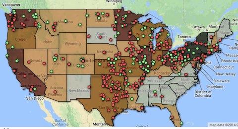
This project allows us to explore the relationships between social movements by bringing them together in time and space. We map the 353 towns and cities that elected socialists to public office between 1904 and 1920. These are interactive maps that can be filtered on a number of variables while providing detailed information about places, publications, periodicals.





Spread the word