Almost three weeks after Hurricane Maria hit Puerto Rico, the island is in a grim state. Fewer than 15 percent of residents have power, and much of the island has no clean drinking water. Delivery of food and other necessities, especially to remote areas, has been hampered by a variety of ills, including a lack of cellular service, washed-out roads, additional rainfall, and what analysts and Puerto Ricans say is a slow and insufficient response from the U.S. government.
Another issue slowing recovery? Maps—or lack of them. While pre-Maria maps of Puerto Rico were fairly complete, their level of detail was nowhere near that of other parts of the United States. Platforms such as Google Maps are more comprehensive on the mainland than on the island, explains Juan Saldarriaga, a research scholar at the Center for Spatial Research at Columbia University. This is because companies like Google often create maps for financial reasons, selling them to advertisers or as navigation devices, so areas that have less economic activity are given less attention.
This lack of detail impedes recovery efforts: Without basic information on the location of buildings, for instance, rescue workers don’t know how many people were living in an area before the hurricane struck—and thus how much aid is needed.
Crowdsourced mapping can help. Saldarriaga recently organized a “mapathon” at Columbia, in which volunteers examined satellite imagery of Puerto Rico and added missing buildings, roads, bridges, and other landmarks in the open-source platform OpenStreetMap. While some universities and other groups are hosting similar events, anyone with an internet connection and computer can participate.

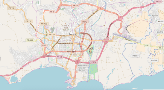
Volunteers have been concentrating on mapping the city of Ponce, on Puerto Rico’s southern coast. (OpenStreetMap)
Saldarriaga and his co-organizers collaborated with Humanitarian OpenStreetMap Team (HOT), a nonprofit that works to create crowdsourced maps for aid and development work. Volunteers like Saldarriaga largely drive HOT’s “crisis mapping” projects, the first of which occurred in 2010 after Haiti’s earthquake.
In the aftermath, Haitians sent texts to let rescuers know where to find them; some even communicated while trapped under buildings. “It was hard to locate those places without a good map,” says Tyler Radford, HOT’s executive director. “We sprang into action and filled in basic roads and buildings as a starting point for relief operations.”
Radford says that at last count 2,800 volunteer cartographers have worked in OpenStreetMap in response to the recent Caribbean hurricanes, adding over half a million buildings. Partners on the ground, such as the American Red Cross and FEMA, use these constantly updated maps.
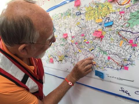
Dale Kunce is the lead on maps and open data for the Red Cross, and is also the president of HOT’s board. He was recently in Puerto Rico, where he leaned heavily on OpenStreetMap. “As our teams went out in the field, they had the freshest data,” he says. “We’d also put data into mobile applications that allowed us to have offline maps, which key as cellular service is sparse.”
Kunce’s teams would mark up the maps with road and bridge closures so that future teams would know to avoid those routes. “They’d go around them, or perhaps figure out a way to get across, in order to reach a community that needs help,” he says.
Kunce adds that he was struck by the fact that his and FEMA’s teams were both using these same crowdsourced maps. “This is foundational for disaster response,” he says. “Getting everyone to have a common operating picture is really valuable.”
Radford notes that while crisis mapping is imperative, the cartography is also crucial for long-term recovery. Nepal, for instance, is still recuperating from its 2015 earthquake. In the wake of the disaster, HOT had 8,000 volunteers working with a local affiliate to map the affected areas in detail. “Once we create these maps,” says Radford, “they can be used down the road.” In Nepal, this has included assessing the damage level for each individual home and planning reconstruction.
It’s clear that Puerto Rico is also going to need sustained assistance. The lack of electricity, which will not be restored for months, is already sparking a severe health-care crisis. With many residents also still low on food and clean water, it’s no wonder that those who are able to do so are leaving for the mainland. Mapping is one part of what will need to be a gargantuan U.S. recovery effort, and Kunce says he’s in it for the long haul.
“We’re going to be doing the same sort of work to understand where we can provide long-term support and aid,” he says.
______________________________________________________________
Mimi Kirk is a contributing writer to CityLab covering education, youth, and aging. Her writing has also appeared in The Washington Post, Foreign Policy, and Smithsonian.


Spread the word